Honolulu channel markers: A Boat Tour Guide
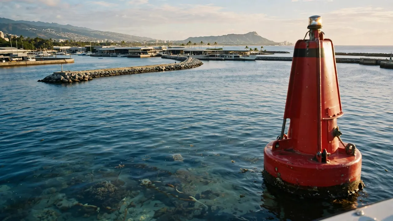
Honolulu channel markers help your captain identify channel edges and follow harbor approaches. The basic rule is “red right returning”: when entering from the sea, red lateral markers belong on the vessel’s right.
With Living Ocean Tours, your adventure begins at Kewalo Basin Boat Harbor, where these navigation aids are part of a working waterfront. You don’t need boating experience to enjoy the ride, but recognizing a few patterns makes the departure more interesting.
Start with colors and shapes, then connect them with the harbor and coastline around you.
Key Takeaways for Your Boat Tour
- Red lateral markers belong on your right when returning from sea; green markers belong on your left.
- Your departure at Kewalo Basin is separate from commercial Honolulu Harbor and isn’t a boarding location on Waikiki Beach.
- Buoy colors, shapes, numbers, and lights work together, while your captain also accounts for charts, traffic, reefs, and conditions.
- Stay out of navigation channels when swimming, and leave navigation decisions to the crew during your tour.
How to read Honolulu channel markers
Red and green identify channel sides
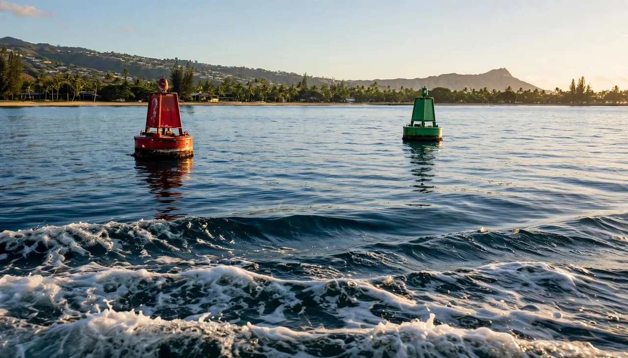
The familiar color system becomes easier to understand once you establish which way the boat is traveling. When approaching a harbor from the ocean, red marks identify the starboard, or right, side. Green marks identify the port, or left, side.
When your boat heads out to sea, those sides reverse. Therefore, seeing a red buoy on your left during departure doesn’t mean the captain has made a mistake.
The Coast Guard’s navigation aids guide explains this lateral system. The direction of return matters more than where the shoreline appears beside your seat.
Shapes and numbers reinforce the colors
Red lateral markers carry even numbers, while green markers carry odd numbers. Numbers generally increase as you travel inward.
For unlighted buoys, red “nun” buoys have cone-shaped tops. Green “can” buoys have flat tops and cylindrical bodies. Fixed daymarks use red triangles or green squares.
However, not every buoy has the same construction. Lighted buoys may have supporting towers, so shape alone isn’t enough.
Try noticing color first, then number and shape. Your captain combines those clues with the charted position rather than relying on one feature. From a passenger seat, that sequence gives you a useful way to follow the channel without interpreting every aid.
Know which Honolulu harbor you’re leaving
Kewalo Basin is our departure harbor
Your Living Ocean Tours boarding point is Kewalo Basin Boat Harbor, at 1125 Ala Moana Boulevard, Slip B-01, Honolulu. It sits near Waikiki in the Kakaako waterfront area.
Here, fishing vessels, excursion boats, and recreational craft share a working harbor. Give dock lines, boarding lanes, and crew work areas plenty of space.
Kewalo’s approach passes through reefs from Mamala Bay. NOAA describes a channel marked by lighted buoys and a directional light. Those aids help explain why your captain follows a defined entrance rather than heading directly toward open-looking water.
Honolulu Harbor is a separate commercial port
Commercial Honolulu Harbor accommodates cargo vessels and passenger ships. Boarding a cruise ship there doesn’t mean your snorkeling excursion leaves beside it.
Its entrance also has its own navigation aids. NOAA describes lights, buoys, and a lighted range along the entrance channel. Range lights provide an alignment reference when viewed together along their intended line.
The United States Coast Pilot supplies local information that complements nautical charts.
When you hear references to Honolulu channel markers, remember that the phrase covers different harbor approaches. It doesn’t describe one continuous corridor connecting every waterfront destination. Neither harbor’s name guarantees that your tour will pass through the other.
Other buoy patterns you’ll notice offshore
Red-and-white stripes differ from red-and-green bands
A red-and-white vertically striped buoy is a safe-water mark. It indicates navigable water around its position and often identifies an approach or midchannel location.
One local example is Honolulu Harbor Entrance Lighted Buoy H. NOAA describes its red-and-white stripes and red topmark. Its pattern differs from a solid-red lateral marker, even though both include red.
Meanwhile, a buoy with horizontal red-and-green bands identifies a preferred channel at a junction. Its uppermost color determines how you interpret it under the lateral system.
Among Honolulu channel markers, these patterns explain why “red means right” needs context. The BoatUS guide to navigation aids describes the wider system beyond ordinary channel-edge buoys.
White-and-orange marks communicate different instructions
White regulatory markers use orange symbols to communicate restrictions, hazards, or information. An orange diamond identifies danger, while a crossed diamond identifies an area where boats are excluded.
An orange circle indicates an operating restriction. The wording supplies the actual instruction, such as a speed limit. An orange square or rectangle carries information.
These symbols aren’t channel-edge markers, so don’t apply the red-right-returning rule to them.
Also, a navigation buoy isn’t a place to tie up. Mooring buoys have a different purpose. Unless the crew directs an authorized mooring operation, leave buoys untouched and enjoy observing them from aboard.
Why a buoy doesn’t tell the whole story
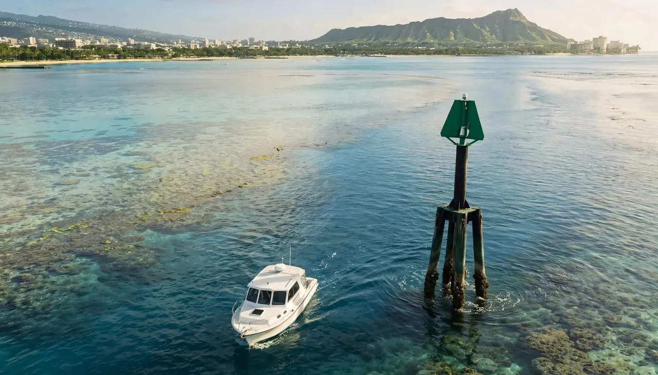
A buoy helps identify a channel, but it doesn’t display every reef, depth change, or underwater obstruction. Bright blue water can conceal shallow ground, while darker patches can reflect depth, reef, or cloud shadow.
Your captain reads Honolulu channel markers alongside charted depths, vessel position, traffic, and conditions. NOAA nautical charts provide the chart information behind that process.
GPS supports position awareness, but the crew still maintains a visual lookout. Wind, swell, visibility, and nearby vessels can all affect the course.
A channel marker identifies a route for vessels; it doesn’t identify a safe place to swim.
That distinction matters near harbor entrances and offshore snorkeling areas. Seeing clear water beside a buoy doesn’t make the location suitable for entering the ocean.
Your experience can also change as the boat clears the harbor. Protected dockside water may look calm while offshore swell produces more movement.
Therefore, secure your belongings before departure and use railings when moving around. If you’re sensitive to motion, prepare before boarding and tell the crew early if you feel unwell.
Landmarks such as Diamond Head help you understand the coastline. However, they don’t promise a fixed route or replace the captain’s navigation decisions.
Enjoy the channel crossing with our crew
You can enjoy spotting navigation aids without taking responsibility for interpreting them. Our captain handles the course while you settle in, watch the waterfront, and listen to passenger instructions.
At Living Ocean Tours, we’re the only tour company with professional snorkel guides. That support matters when your adventure moves beyond the boat and into the water, especially for beginners.
Our Coast Guard-inspected double-decker vessels also offer shaded seating and onboard restrooms. These practical comforts give your family places to settle between coastal views and ocean activities.
Before departure, keep children close and wait for the crew’s invitation to board. Don’t step on dock lines or move ropes, even if they appear to block your path.
Once underway, secure loose hats and phones. Remain seated when directed, particularly during harbor maneuvers or changes in sea conditions.
You can explore our Honolulu ocean tour options to choose an outing that suits your group’s interests. Whatever you choose, your role stays simple: follow the crew, give wildlife space, and enjoy the coast.
Frequently Asked Questions
Do you need to understand Honolulu channel markers before boarding?
You don’t need navigation training to join a guided boat tour. Your captain handles the channel approach, vessel movements, and route decisions.
Knowing the basic color system simply adds context to what you see. Your most important responsibilities are listening to the briefing, keeping pathways clear, and following crew directions throughout the outing.
Why does the boat slow down or change direction near buoys?
Harbor approaches give vessels less room to maneuver than open water. Your captain may adjust speed or direction because of the channel alignment, nearby traffic, swell, or passenger safety.
A turn near a buoy doesn’t automatically indicate a problem. Likewise, a horn can communicate a maneuver between vessels. Stay calm, remain clear of crew work areas, and follow instructions.
Can you swim or snorkel beside a channel buoy?
You should stay out of active navigation channels and harbor entrances. These are travel routes for vessels, and swimmers can be difficult to see.
On a guided outing, enter the water only where and when the crew directs you. Once you’re swimming, stay within the designated activity area, float above coral, and observe wildlife without touching or chasing it.
Make Your Harbor Departure Part of the Adventure
Understanding marker colors and shapes gives you another way to appreciate Honolulu’s waterfront. The strongest takeaway is direction matters: red-right-returning applies when approaching from sea, while other buoy patterns carry different meanings.
Start at the correct harbor, give the crew room to work, and leave navigation decisions with your captain. Then you can enjoy the channel crossing as the first part of your ocean adventure.