
AIS Commercial Vessels Broadcast: A Boat Tour Guide
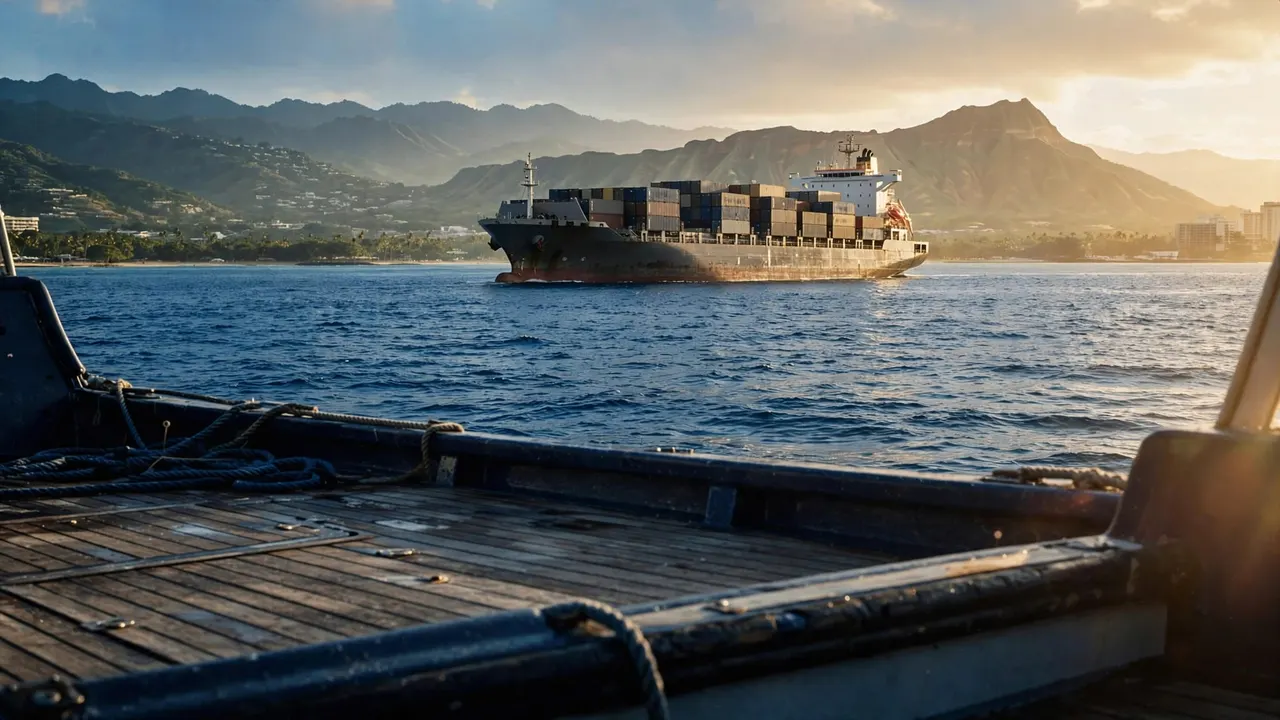
The AIS commercial vessels broadcast can help identify ships near your boat by sharing details such as their position, course, and speed. On a Living Ocean Tours outing near Waikiki, those distant ships can be fascinating to watch while our captain handles navigation.
AIS is one part of a layered approach to awareness. Knowing what the information means can make your view of the ocean more interesting without putting navigation decisions on your shoulders.
What AIS Shows Aboard a Boat

The Automatic Identification System, or AIS, allows equipped vessels to broadcast information over marine VHF radio frequencies. Suitable receivers can pick up those broadcasts and present vessel details on a compatible display.
According to the U.S. Coast Guard’s AIS overview, AIS works as a shipboard broadcast system. It can update information as often as every two seconds, although you shouldn’t expect that rate for every vessel or every display.
The AIS commercial vessels transmit may include identifying details and information about their movement. Depending on the equipment and data available, a crew can select a target on a display and see more about it.
For you as a passenger, that information can add context to a ship you’ve spotted. A large silhouette offshore might be recognizable as a cargo vessel by sight, while an AIS report could provide its name and course.
A screen only shows information it receives. A boat without a usable AIS transmission can still be nearby, so a captain continues to watch the water and use other available tools.
Reading the Details in an AIS Report
An AIS report can combine information about a vessel’s identity with data about its movement. Those details answer different questions, and some fields may be unavailable or outdated.
Name, identity, and vessel type
A vessel’s name is often the easiest detail for a passenger to recognize. Its reported type can also provide context, although it may use a broad category rather than a description of the cargo on board.
Another identifier is the Maritime Mobile Service Identity, or MMSI. The Coast Guard describes it as an official nine-digit number assigned for maritime radio identification. You can read more in the Coast Guard’s AIS questions and answers.
Other reported fields may include a call sign and vessel dimensions. These details are useful for identification, but they depend on the information entered and transmitted by the vessel.
Position, course, and speed
Position places a vessel on the chart. Course over ground describes the direction it’s moving across the Earth’s surface, while speed over ground describes how fast that movement is.
Speed is commonly shown in knots. One knot equals one nautical mile per hour, so a speed reading tells you how fast the vessel is traveling, not how far it is from your boat.
The AIS commercial vessels share can make their movement easier to follow over time. Still, a single report is a snapshot. A ship can change course or speed after transmitting it.
How Captains Interpret Vessel Movement

An illustration of the distance that can separate a passenger boat and a cargo ship.
A ship’s reported position matters more when you consider it alongside the movement of your own boat. Both vessels may be underway, and their paths can change.
Distance and direction are different
A ship may appear to pass close to Diamond Head from your seat while being much farther offshore. Objects that line up in your view aren’t necessarily close together.
AIS can give a captain more information than that visual lineup. When the display has usable positions, it can help show where a transmitting vessel is in relation to the boat receiving the information.
However, the view from your seat remains useful. You might notice a ship, swimmer, or floating object before realizing whether the crew has seen it. Tell a crew member calmly where to look rather than trying to estimate an exact distance.
A projected path can change
Some displays calculate a closest point of approach, an estimate of how near two vessels would pass if their present movement continued. They may also show the estimated time until that point.
Those figures are predictions, not promises. A course adjustment, a speed change, or delayed information can alter the estimate. The captain considers the whole situation, including visibility, nearby traffic, and available room.
The AIS commercial vessels broadcast is therefore most useful as information to interpret over time. You don’t need to decide whether a crossing is safe from a number on a screen.
AIS, Radar, and Visual Lookouts
AIS and radar provide different kinds of information. A crew may use both when available, along with charts, radio, and direct observation.
AIS receives a broadcast
AIS depends on receiving usable data from a transmitting source. It can provide a vessel’s identity and reported movement, which may help a captain understand what they’re seeing.
The details don’t necessarily describe everything around that vessel. A nearby paddleboarder, floating object, or small boat may not appear as an AIS target.
Radar detects returns
Marine radar sends out signals and displays returns from objects. Unlike AIS, it doesn’t depend on another vessel broadcasting its name or position.
Radar can help a crew assess a target’s location and movement, but conditions and settings affect what appears. Rain, waves, distance, and the size of an object can all make interpretation harder.
A proper lookout remains essential. The captain uses the equipment available on board alongside the view outside, rather than treating any one display as a complete picture.
Why a Vessel May Not Appear on AIS
Carriage requirements vary by vessel and operating circumstances. Although many commercial ships carry AIS, you shouldn’t expect every boat you see to show up on a screen.
Not every boat transmits usable data
Some vessels aren’t required to carry AIS, while others may not be transmitting usable information at a particular moment. Equipment problems or incomplete information can also affect what a receiver displays.
The Coast Guard’s AIS requirements describe the rules for covered vessels. They depend on the vessel and its operation, so a broad claim about every commercial boat would be misleading.
AIS can also show a vessel without giving you every detail you’d like. A missing name or vessel type doesn’t mean there is no boat at that position.
Reception and update timing matter
An AIS receiver only displays reports it receives. Coverage, interruptions, and the age of the last report can affect the picture, particularly when you’re looking at a vessel-tracking website rather than equipment receiving broadcasts locally.
NOAA’s Marine Cadastre AIS FAQ notes that interruptions in its data-collection network can affect records of vessel traffic. An online map and the view from a boat don’t necessarily contain identical information.
An empty area on an AIS display doesn’t establish that the water is clear.
What You Can Notice as a Passenger
Watching commercial traffic is an enjoyable part of being on the ocean. You can follow a vessel’s silhouette and movement while leaving the decisions about course and speed to the captain.
Look for changes without guessing too precisely
A cargo ship may appear small because it’s far away, even though it’s much larger than a nearby boat. Haze, rain, glare, and waves can also hide details or make distance harder to judge.
Watch the ship more than once. If it seems to move across your view, remember that your own boat may be turning or traveling along the coast too.
Polarized sunglasses can reduce reflected glare at some angles, although they won’t reveal details hidden by haze or distance. If you use binoculars, find the vessel with your eyes first and stay seated when the crew asks you to.
Give the crew room to work
Keep walkways clear and secure loose belongings before the boat gets underway. If you see something that concerns you, point it out to a crew member with a useful direction, such as “off the right side near the horizon.”
A change in speed or a pause near a harbor entrance can be part of normal boat handling. The captain may be responding to traffic or conditions that aren’t obvious from your seat.
Enjoying the View With Our Crew
You can take in the Waikiki coastline and offshore traffic while our crew manages the boat. If your outing includes snorkeling, our professional snorkel guides can help beginners feel more comfortable in the water.
Listen to the safety briefing and follow the crew’s directions throughout the trip. When you encounter marine life, observe without touching and give animals room to move.
Key Takeaways for Watching Ships
AIS can add a name and movement information to the vessel you see offshore. The AIS commercial vessels use also gives a captain another source of information when considering nearby traffic.
Keep these points in mind:
- A ship’s reported course and speed can change after an AIS update.
- A vessel that doesn’t appear on AIS may still be on the water.
- Radar, visual observation, and AIS provide different information.
- Your captain makes navigation decisions using the information available.
Frequently Asked Questions
Can AIS tell you the name of a ship?
It can, if the vessel transmits its name and a receiver picks up that information. Some reports may have missing or incorrect fields, so a display doesn’t always provide a complete profile.
Does AIS show a ship’s exact future path?
No. Course and speed describe reported movement, and a display may use them to estimate a future position. The ship can turn or change speed, so that estimate can change.
Can you use a phone to identify a ship?
Vessel-tracking apps and websites can display AIS information. Their coverage and update timing vary, so the map on your phone may not match what you can see from the boat.
Does radar show the same information as AIS?
Radar can show a return from an object without receiving an AIS broadcast. AIS can provide identifying information, such as a vessel’s name or MMSI. Each tool gives the captain a different view of nearby traffic.
Enjoy the Ships Without Taking Over Navigation
The AIS commercial vessels broadcast gives their identity and movement more context than a silhouette alone. It’s useful information when a receiver picks it up and the crew interprets it alongside the conditions on the water.
As a passenger, you can enjoy spotting ships and asking questions. Leave the navigation decisions to your captain, and keep your attention on the ocean around you.